This past November I ran the first edition of the Morocco Race 65km Ultra Marathon. While this wasn't the first ultra race I had ever ran, it was my first in Morocco so I wasn't sure what to expect.
Before I get into my race report let me just say that I wasn't expecting to run an ultra last year. I had been training for the 2015 Casablanca Marathon and was surprised one afternoon when my wife told that she had found a new race online and it was going to be only a month after finishing the Casablanca race. Realizing that even though there would be enough time to recover (sort of) but not really enough to retrain for the extra distance, I went ahead and registered. It also helped that the start and finish of the race were only about 45 minutes from Marrakech where I live.
Registration was simple enough. They offered online registration for anyone coming in from out of country or for those of us who live locally we were able to register at the new Decathlon sports store right here in Marrakech. I filled out the paper, paid the entry fee and that was it. The only other thing they needed was a doctor's release form saying I was ok to run a long race.
All that was left for me was to run the Casablanca Marathon and not get injured.
Pre-race and check-in

This is the registration area as well as the start and finish area for the race
The day before the Morocco Race my family and I drove up to Teres Armanar. It's a hotel/events/zip line/retreat center located at the foothills of the Atlas Mountains and also was playing host to the start and finish area for the race. We had booked a room online and once we got there we were very pleased with the quality of the room. In fact I was impressed many times during our stay at the quality of the place.
Next was check-in for the race, which again was super simple as the total number of runners was quite small. I got my race number and a bag with some swag in it. Then it was off to bed.
The Race
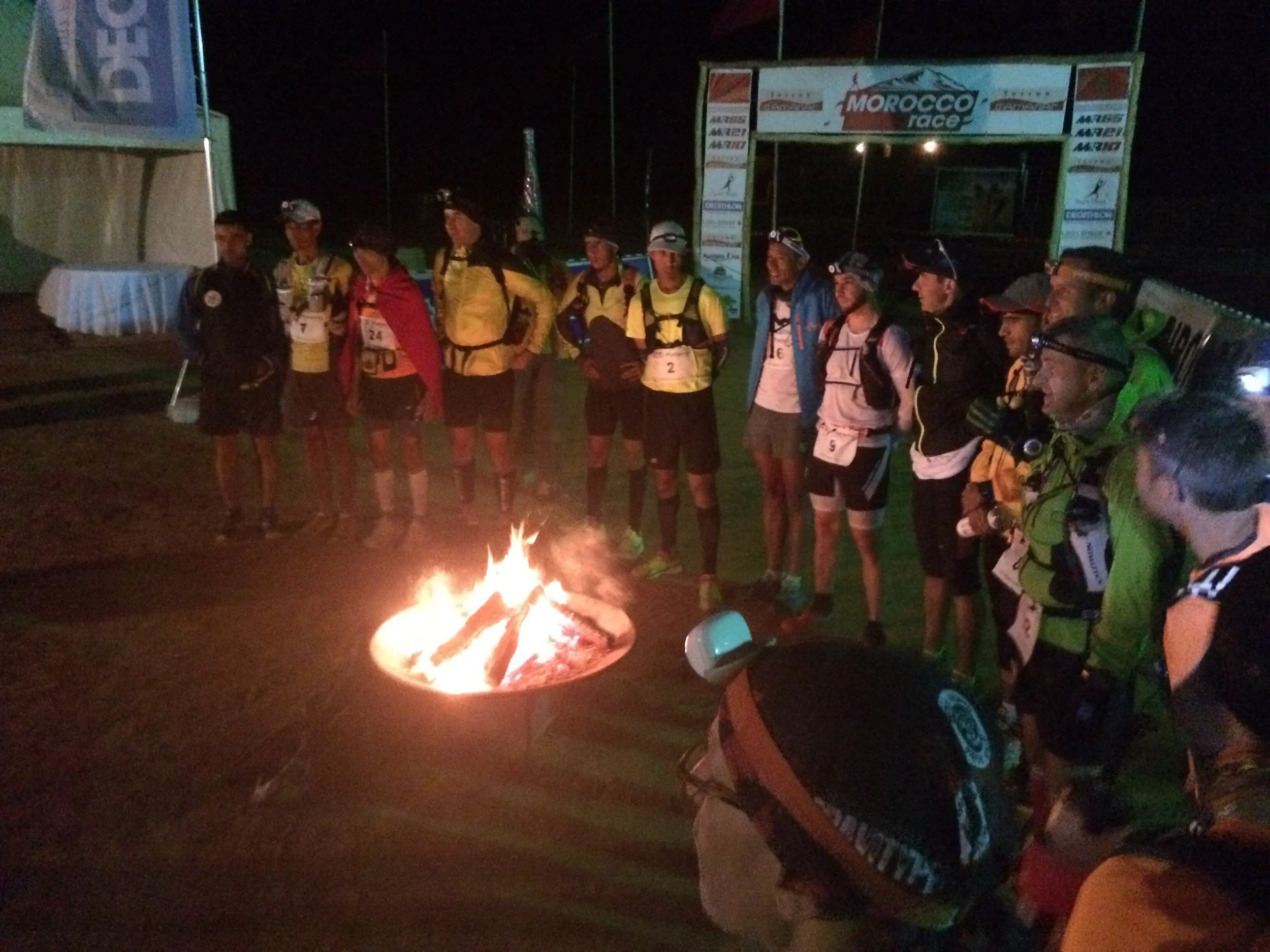
The fire to warm up at was a nice touch for the 5am start
The 65km event was set to begin at 5:30am, so after getting ready and having a small breakfast I headed to the starting line. After introductions and some pictures the race was off just a few minutes after the planned starting time. The first hour of the run was in the complete darkness with the only light coming from the headlamps we were all wearing.

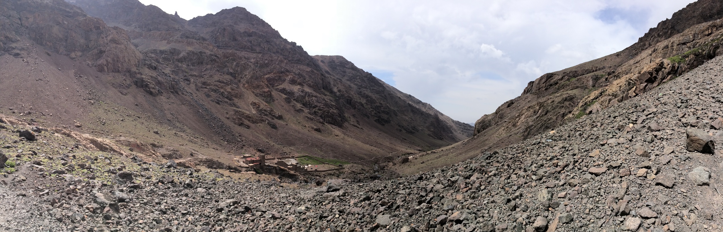
One of the beautiful views during the race
If I had had any apprehension that this was going to be an easy run that was all taken away very early. While not crazy steep the trail pretty much was nothing but climbing around 1,800 feet in just the first hour. In fact by just four hours in I had climbed more than 3,600 feet with very little decent and reached the second highest peak of the race at 7,246 feet. I came to the highest point only an hour later at 7,311ft.
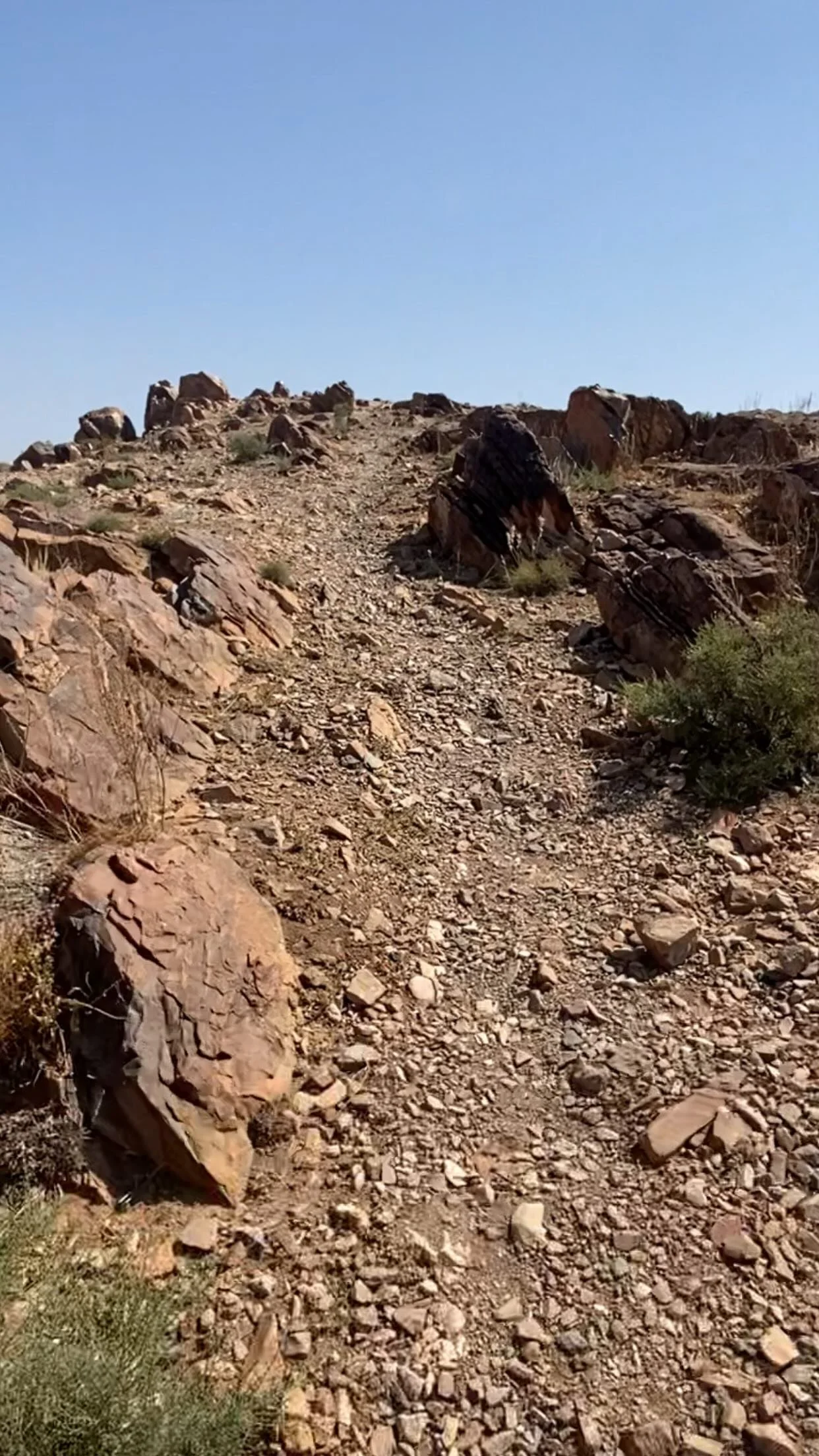
However, for the majority of the race one of my unfounded worries was about getting lost. Out in the Moroccan Atlas Mountains there may not be a lot of people but there are a lot of trails made by shepherds and their animals. Thankfully, the race course was actually rather well marked. The race organizers used a mixture of bright orange spay paint and flags on trees to mark the way. I only missed one turn, because I was messing with my pack, and got back on track relatively quickly. There was only one place where myself and another runner were unsure of and that was because there were some markings from another race.

This was one of the best aid stations during the entire race
After climbing for the first four+ hours I came to the first big aid station and took about seven minutes to sit down and refuel. Many of the aid stations just had water, juice, and a selection of dates and bananas, but every few ended up being very well stocked with soup, Moroccan cakes, Coca-Cola, Nutella, fruit, and more.
The second half of the Morocco Race, while being mostly downhill still had some massive climbs in it which coming in the second half the race really wiped me out. Since I hadn't really been training in the mountains, that really did me in. By the last four miles I was exhausted. I would manage to jog on some of the downhills and a few of the flat parts of the trail (very rare) but was moving very slowly on the final up-hill climb.

Getting my finishers metal after crossing the finish line
Thankfully the final stretch of the race is all down hill coming into the finish area. This was nice because as I came back into the hotel area I was actually "running" and was able to cross the finish line running with my 4 year old son. My final time 10 hours and 48 minutes with my Garmin saying a total elevation gain of 12,877 feet.
Final Thoughts

One of the many mountain villages we passed through during the race
The trails that the Morocco Race took us out on were amazing. I have spent some time in the Atlas before but the views I got during this race were almost unmatched. We ran through villages, forests, bare Rocky Mountain tops, past flocks of sheep and goats, and saw glimpses of the tallest peaks in North Africa. This is definitely a race I will be running again in the future.
One note about gear. I would highly recommend that whatever shoes you choose to run in rate well on rough rocky terrain. Much of the trail is covered by pointed rocks that can wreak havoc on a runners feet.